Connecting the Farm with the Future of Agricultural Telemetry
The Flint River Soil and Water Conservation District continues to follow the cutting-edge path of agricultural innovation for conservation-driven solutions to natural resource challenges. With other pilot projects currently in progress, we have partnered with an innovative start-up company based in Dallas and London Nwave Technologies.
Advanced irrigation scheduling is a key component of the District’s water conservation efforts, and many of our projects focus on ways to increase accessibility, lower costs, and boost widespread adoption of this tool. The highest cost for a soil moisture sensor is related to the telemetry and transmission of the data to a server that allows the data to be accessed by the farmer or consultant. Precision Agriculture telemetry requires connected sensors to be able to send small amounts of data over long distances using very little power. Existing wireless communications technologies like WiFi and Bluetooth LE are low power, but their range is very limited. On the other hand, there is mobile technology, which is long range, but power-hungry and inefficient for small packet transmission.
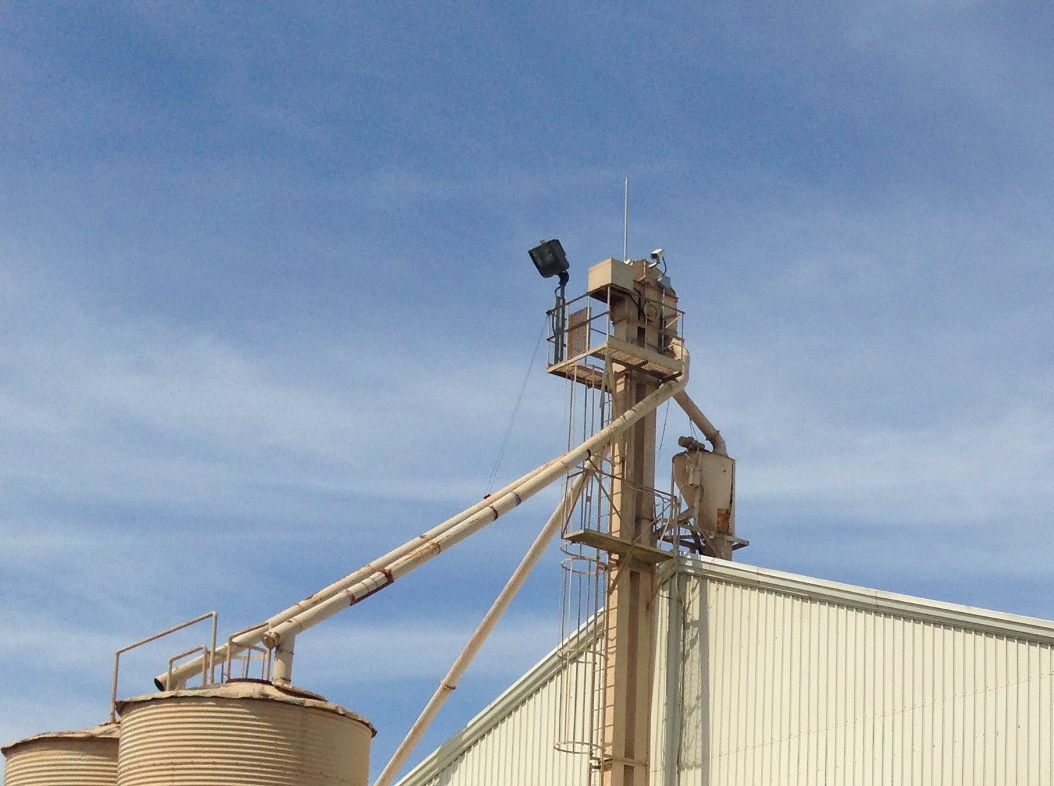
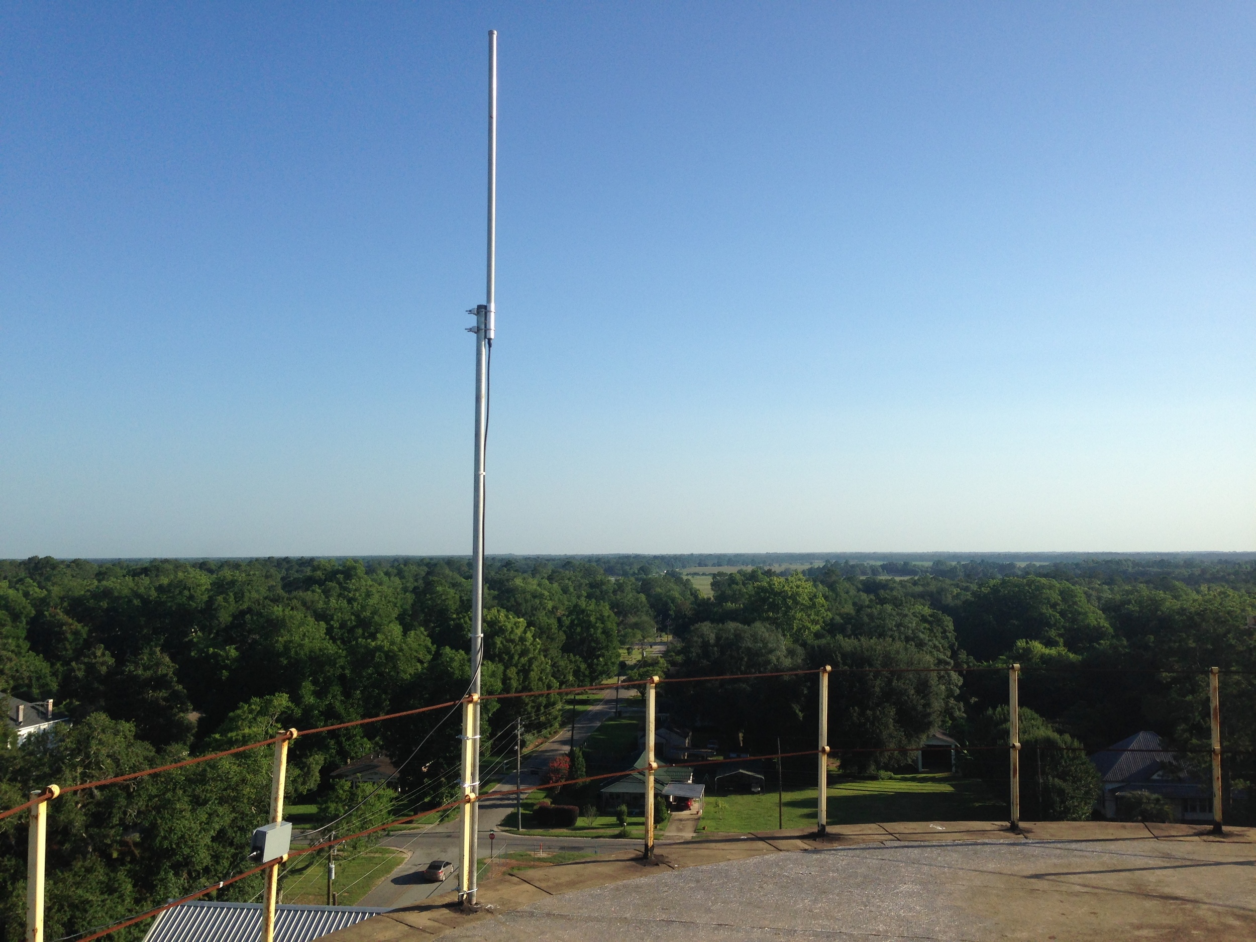
Nwave’s low-power wide area network (LPWAN) communications technology and hardware was designed specifically to transmit small data packets from sensors, at long range using very low power. Using Nwave’s technology devices can transmit data securely over distances of 10-30 miles in rural areas, with power usage so low that they can operate on a single battery for up to 10 years. This significantly reduces both Capex and Opex for large-scale deployments, opening up vast opportunities for irrigation optimization and yield forecast.
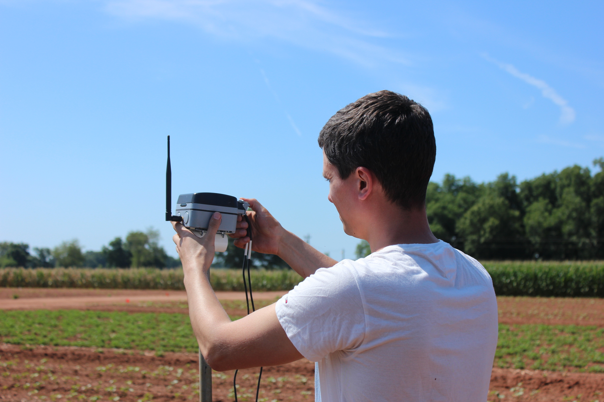
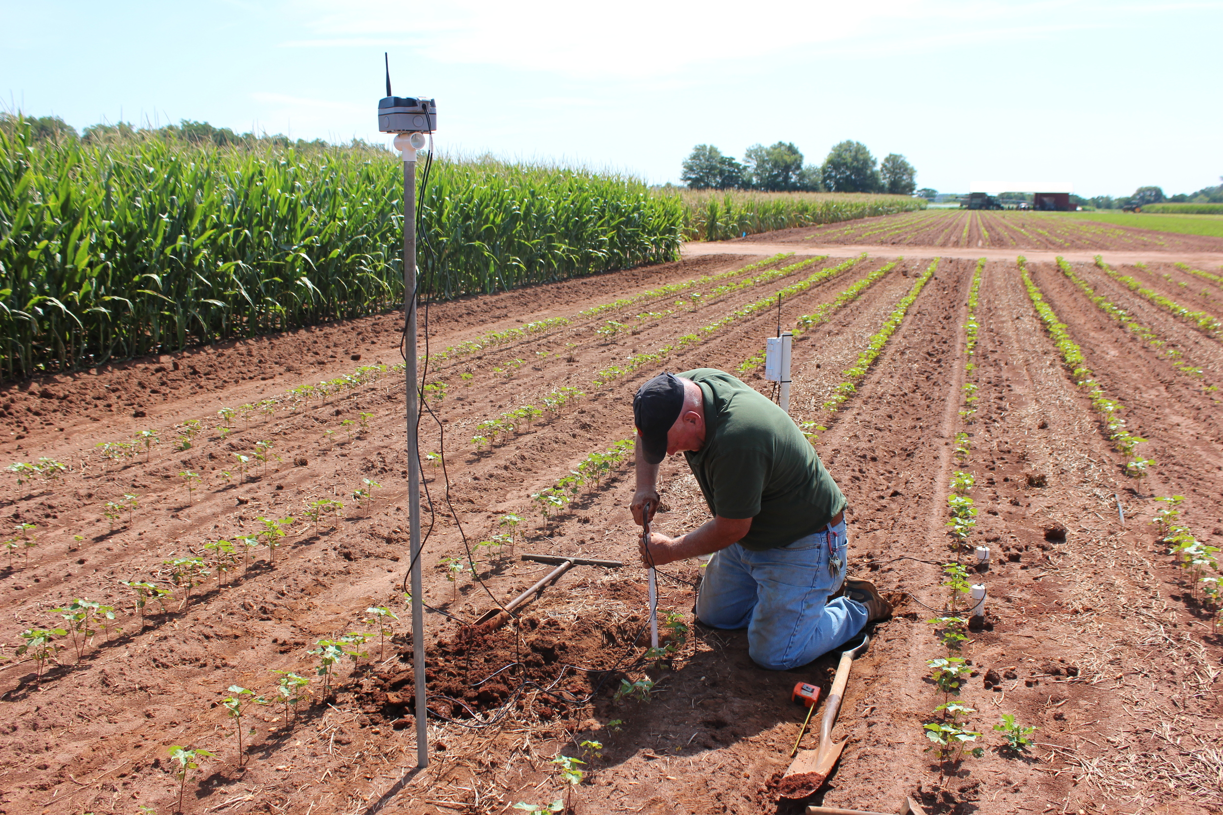
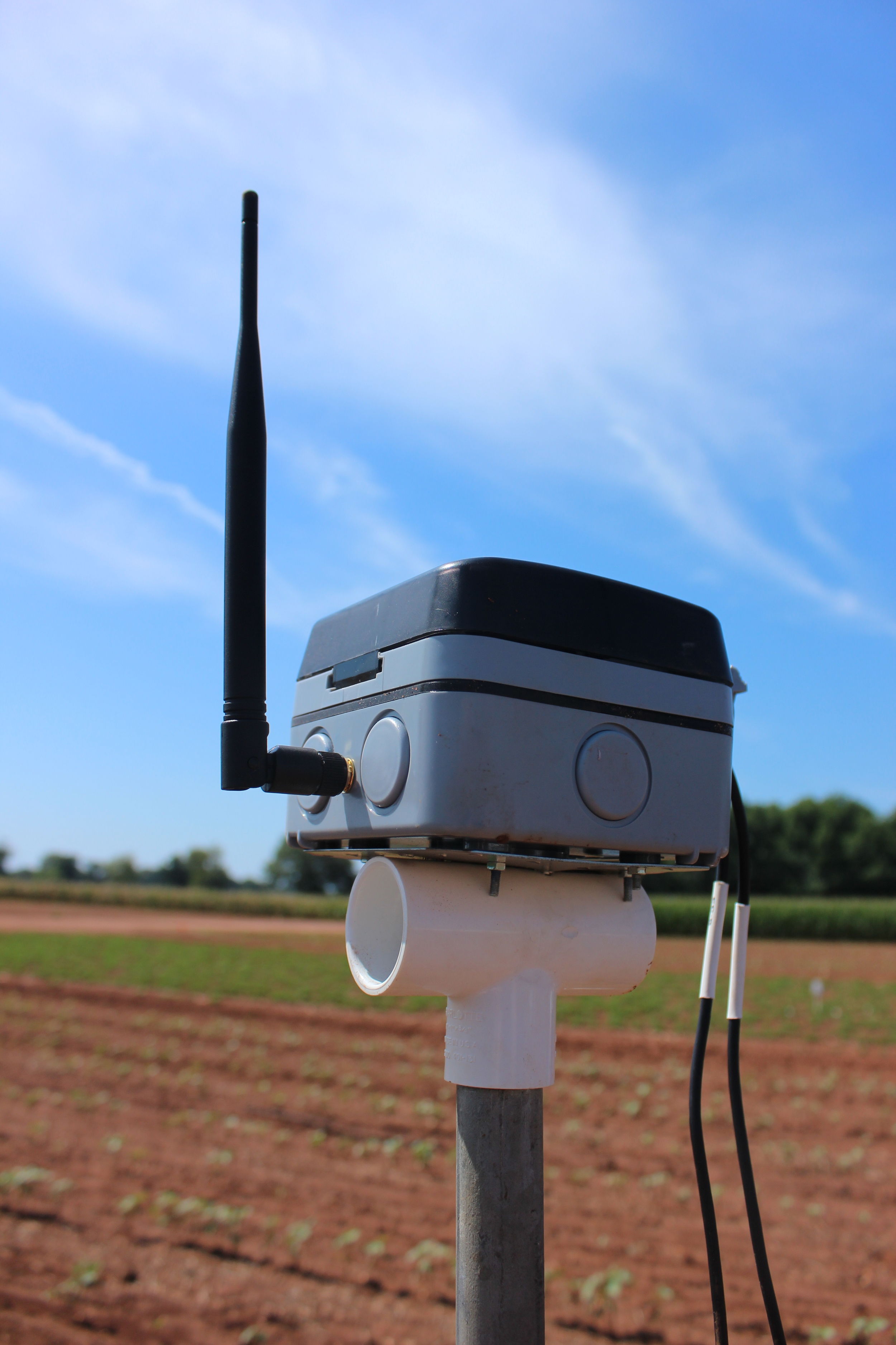
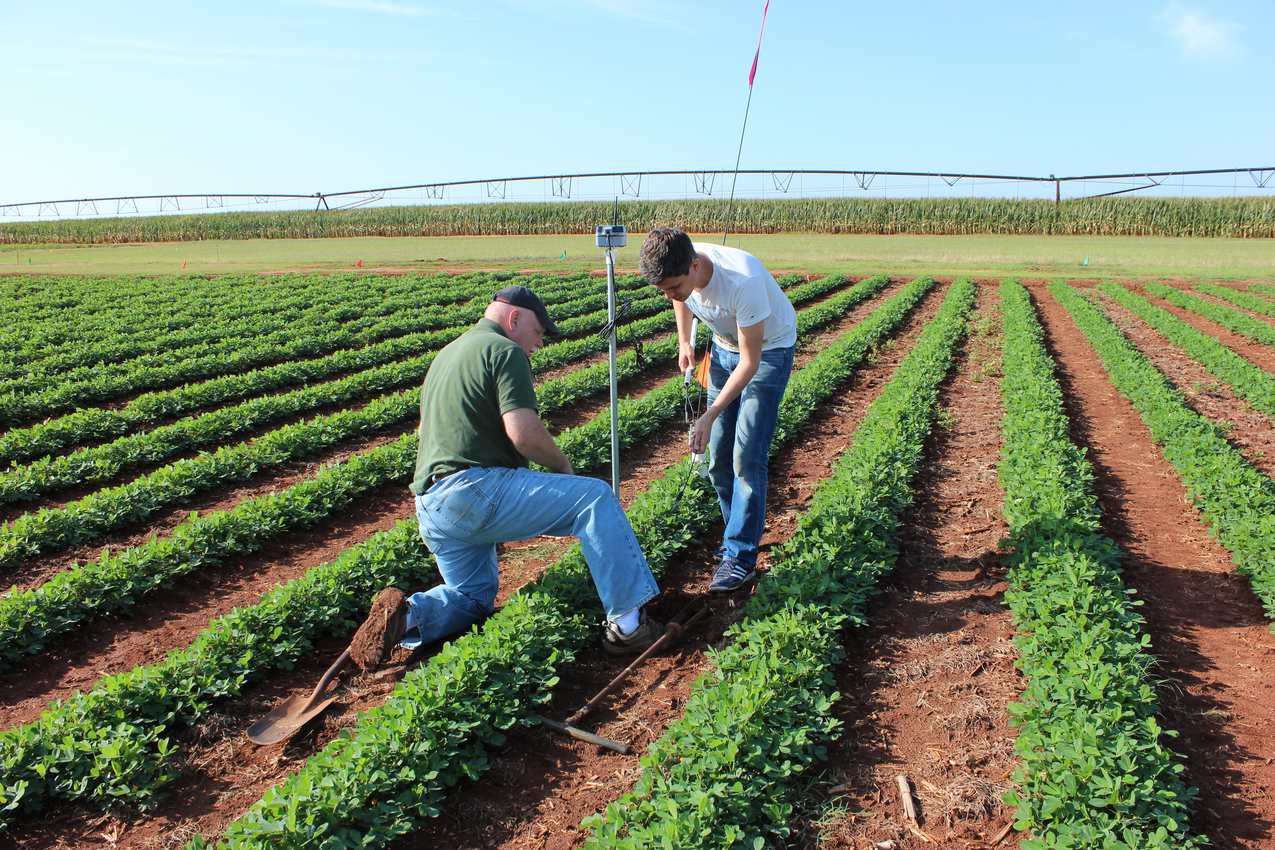
The capacity for this type of technology to be integrated into existing soil moisture sensing systems that are part of our current projects is critical to our long-term conservation objectives. A telemetry range of 10-30 miles would make a significant and positive impact on our sensor networks, allowing our partner team to have more sensors per base station. This year’s pilot project has sensors and Nwave communications technology installed at the USDA Agricultural Research Service (ARS) National Peanut Research Lab (NPRL) in Dawson, Georgia and in Colquitt, Georgia near our Spring Creek project sites. Sensors are installed in fields located anywhere from approximately 3 – 15 miles away from the base stations.
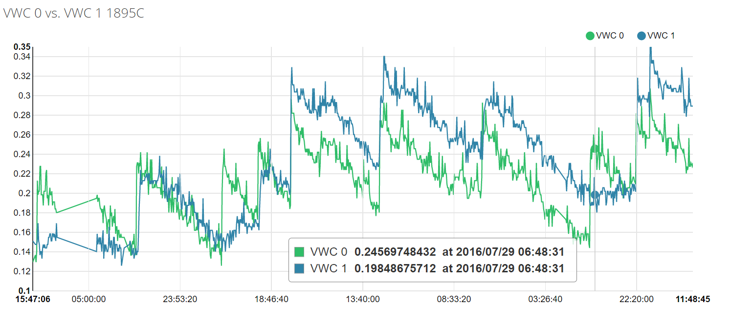
Universal design of Nwave’s Agricultural Data Logger provides easily configurable interface to read data from any digital or analog sensor on the market. This feature allows researches do simultaneous data acquisition from numerous sensors and benchmarking their performance in the same field environment.
Research groups at the NRPL and University of Georgia are evaluating live data and working with Nwave and the District to determine the route for wider adoption of this technology on irrigated landscapes.
We appreciate the opportunity to work with Nwave and pursue innovation that will benefit both farmers and the environment.